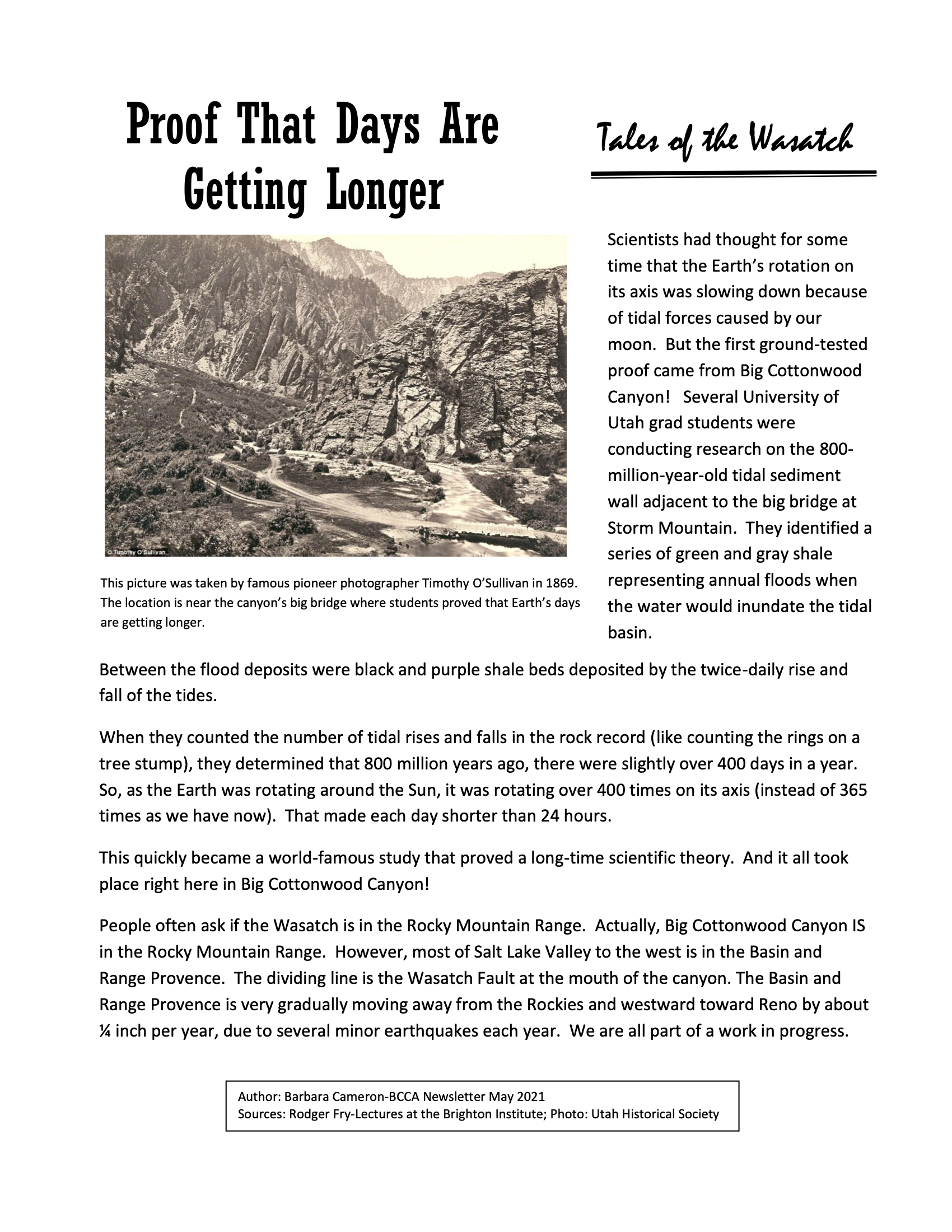
Site 9 – The Stairs and “The Cuts”
Location: Traveling upcanyon, this section begins immediately around the corner after the Stairs Hydroelectric Power Plant, passes through the Cut, and leads across the Maxfield Bridge.
Date: 1854 for the horse and wagon trail that went through The Stairs and the flat, 1895 for the “Jones Hump,” and1916 for the present-day “Cut.”
Significance: The Stairs and the Cut are well known geographic landmarks in the lower canyon. Their history tells the story of the early logging road, the inception of hydroelectric power, and a commitment to clean water.
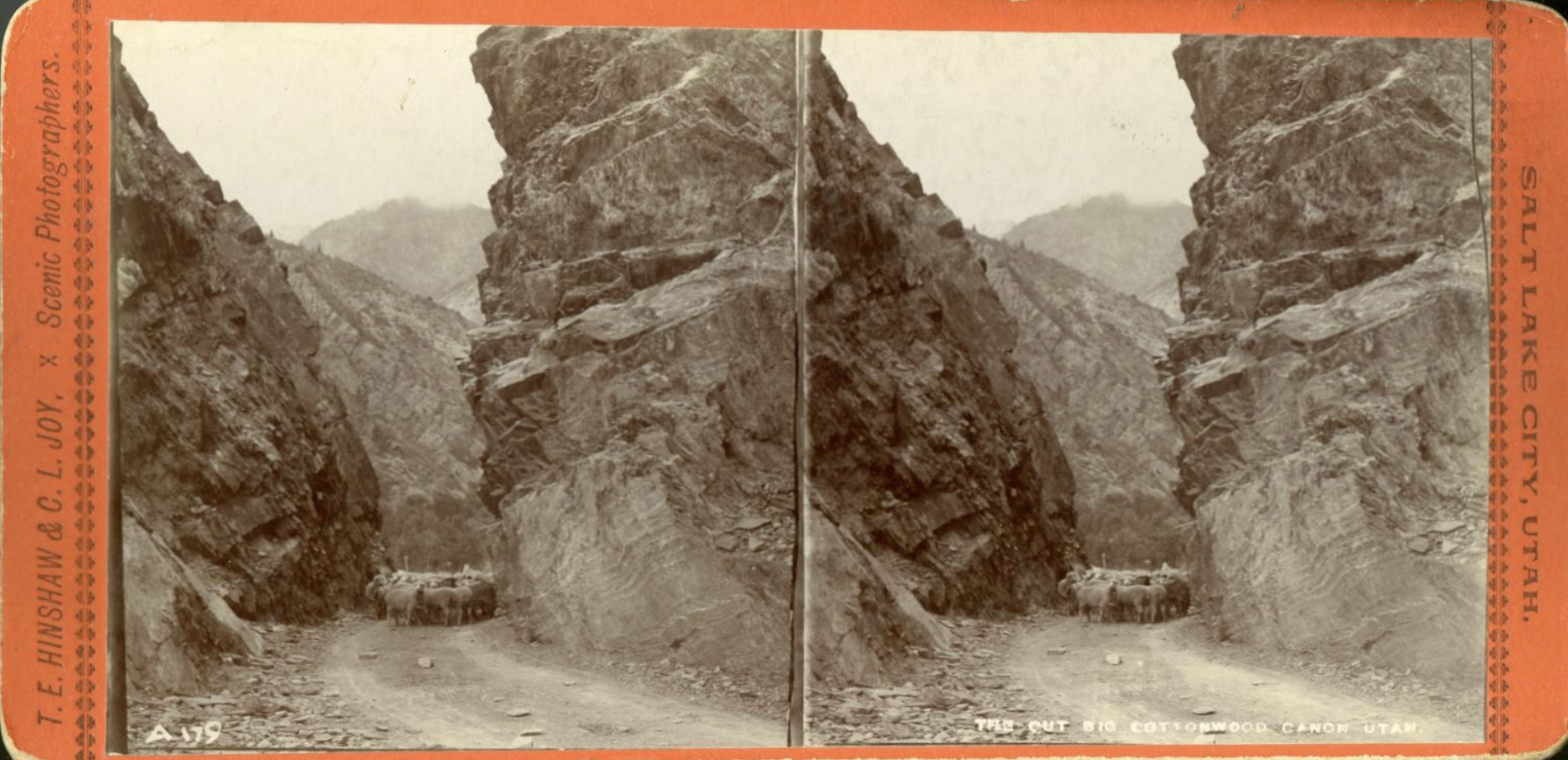
Photo Title: “The Cut Big Cottonwood Canon Utah” (looking upcanyon through the 1895 Cut). This image shows a herd of sheep, taken into the canyon for grazing, coming through the cut. On the back of this stereoscope card is handwritten “Big Cotton Wood Canyon 1896.” [1]
“The Stairs” is a well-known geographic landmark in the canyon. Early travelers, artists, and photographers documented this steep section bordered by high, terraced ledges resembling a staircase. The earliest canyon path was at creek level, much lower than today’s road, making the towering walls of this section even more extreme. The name was explained by James D. Moyle, born in 1901, as he recalled early wagon trips to Brighton as a young boy. He described the Stairs as, “a very steep hill bordered with outcropping ledges that looked like steps (hence the name). That hill was definitely a contest for horses and later cars to negotiate.” [2] In the automobile era, Mary Teerlink recounted a summer trip in 1921 to the MIA Girls Home [3] at Brighton. The girls were transported by trucks furnished by the City Street Department. She wrote, “We had been told what a hard job it was to climb the ‘STAIRS.’ …Each time we started to climb a stair, the driver would put in some cold water from the creek so that the radiator would not boil. He also had us get out several times to lessen the load and we would hike up the steep incline.” [4] As auto ownership increased, advertisements featured cars in the rugged scenery of the Stairs. A 1922 newspaper article titled, “Packard Carries Visiting Society Belles to Scenic Haunts” read more like an advertisement than a society article. The man hosting the two “society belles” from Wisconsin realized the young women were accustomed to a “refined atmosphere” so he used his “Packard single six” for touring Salt Lake highlights. One of his guests, Rose Kastorff told the newspaper, “A feeling of security possessed us as we climbed the severe grades of the ‘stairs’ and Big Cottonwood Canyon enroute to Brighton. I never dreamed that such wonderful scenery existed at the very door of your city.” [5]
The Stairs and the rock cuts that were made exemplify three distinct eras. The first “road” to come through was the 1854 horse and wagon trail, cut alongside the creek, providing access to trees and mills as logging began. That path would have brought travelers to Mill C (existing about 1855-57) and in 1888 to Young’s Peak Lodge [6], a summer resort, which were both located on the naturally flat area where today’s reservoir is.
A major change occurred in 1895 when civil engineer Robert M. Jones reconfigured the road to accommodate the reservoir for the Stairs Hydroelectric Power Plant. The natural flat that had housed Mill C and Young’s Peak Lodge area was perfectly suited to be a reservoir. It was surrounded on three sides by rock, so Jones only had to dam one side to contain the water. To carry the water down to the plant, Jones tunneled 430 feet through the quartzite. The final problem to solve was the location of a new road since the old one would be covered by the dam and reservoir. [7] His solution was to build a steep dugway that climbed to a rocky ridge at the edge of the dam and reservoir. A “cut” was blasted through the highest rocks so that ore wagons and later autos driving up could pass through, make a sharp turn, and descend rapidly down to the new bridge that covered the creek at the upper end of the reservoir. The disgruntled mining teamsters, who now had additional uphill and downhill road, with no flat to rest their animals after the initial trip up the Stairs called the dugway and cut the “Jones Hump.” You can see the old dugway today on the south side of the canyon road opposite the entrance to Storm Mountain Picnic area. Large rocks at the entrance block cars from parking or driving on this old road. You can follow the path a short distance upcanyon to the parking lot and envision where wagons and cars approached to the 1895 rock cut. Now, the cut looks more like a saddle since rock has filled in over the years, but old photos show the 1895 cut looking similar to the present-day cut. The reservoir for the power plant, which still generates electricity, is now significantly modified with a much smaller area containing water.
The last major modification was the creation of the 1916 cut (and closure of the 1895 cut) that we drive through today. The reason for the new cut, adjacent to the old one, was to decrease the road grade so that trucks or tractors could move the mining ore instead of horses with wagons. The concern was water contamination from horse waste since there could be as many as seventy four-horse teams going up and down the canyon daily. [8] After many years of road improvements, the 1916 Cut still sits at the same alignment as the old one, but the road is wider and sits at a higher level. [9] The Stairs and “the Cuts,” well-known landmarks in the lower canyon, illustrate the story of Salt Lake City’s growth and needs; a logging road to bring materials to the growing city, the dugway and 1895 Cut when city electricity was first produced by the creek power, and finally the 1916 Cut to reduce the road grade and decrease horses in the canyon to protect the water supply for the expanding municipality.
Interesting Fact: The Stairs and The Cut (also known as The Notch and Silent Curve) are especially busy in the summer. Cars are often parked here since there are numerous rock climbing routes on both sides of the canyon. You can see rock climbers scaling the walls during the day or their headlamps as they descend at night. At sunset, people make the short hike up to the saddle where the 1895 Cut was located. It’s a fabulous spot to watch thelight dramatically change over the Storm Mountain area.
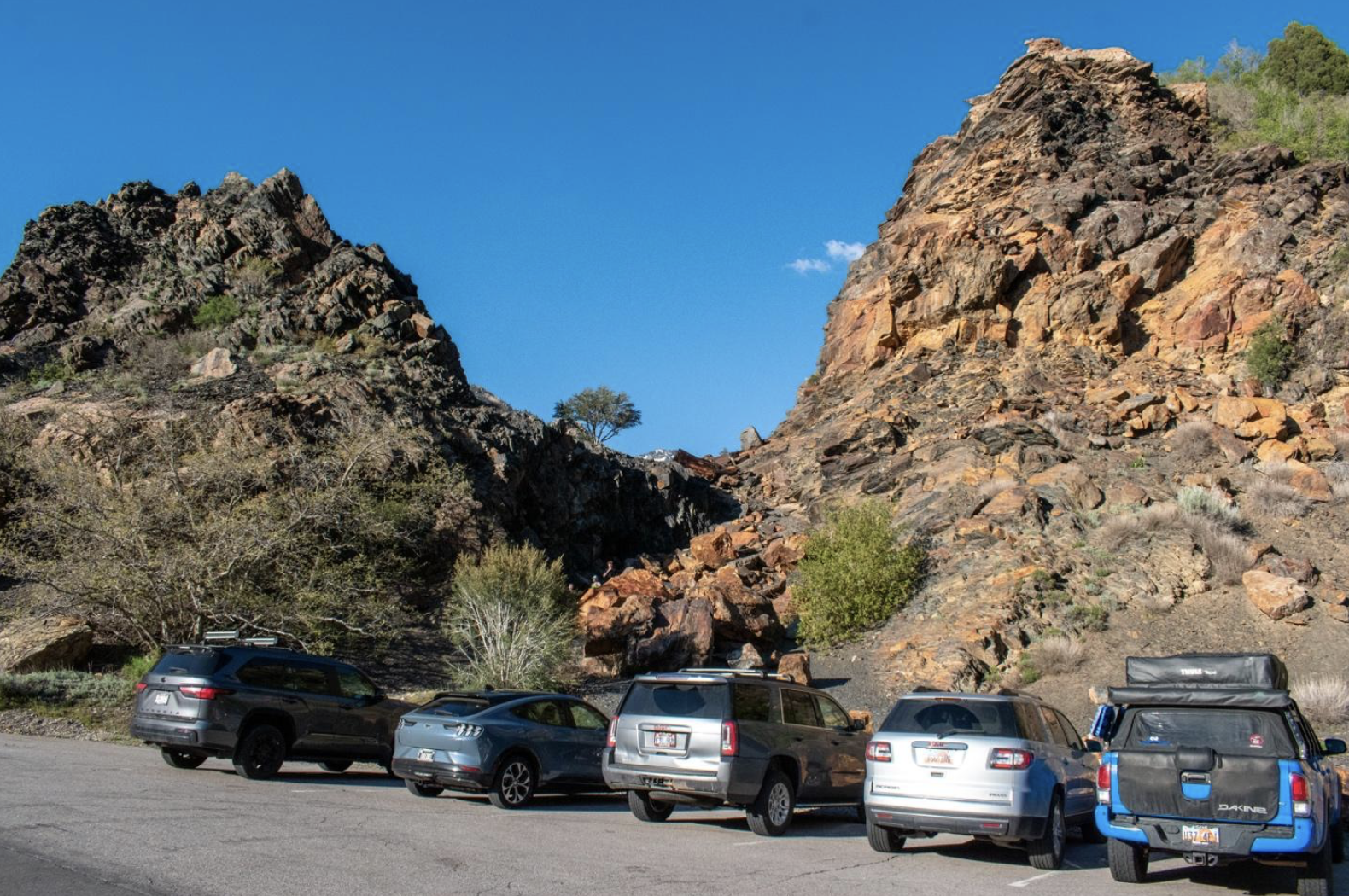
Photo Title: “The 1895 Cut Looking Upcanyon.” The Cut looks more like a saddle since it has been filled in over the years. The entrance to the dirt dugway leading up to the Cut is located across the road from the Storm Mountain Picnic Area entrance. [10]
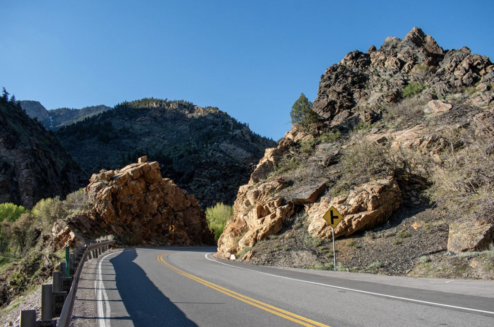
Photo Title: “The 1916 Cut Looking Upcanyon.” [11]
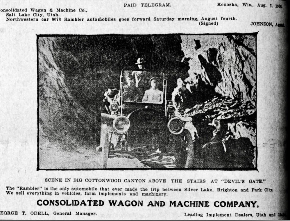
Photo Title: Scene in Big Cottonwood Canyon Above the Stairs at “Devil’s Gate. ‘The Rambler’ is the only automobile that ever made the trip between Silver Lake, Brighton and Park City.” [12] This 1906 photo was taken at Devil’s Gate, a nickname for the 1895 Cut.
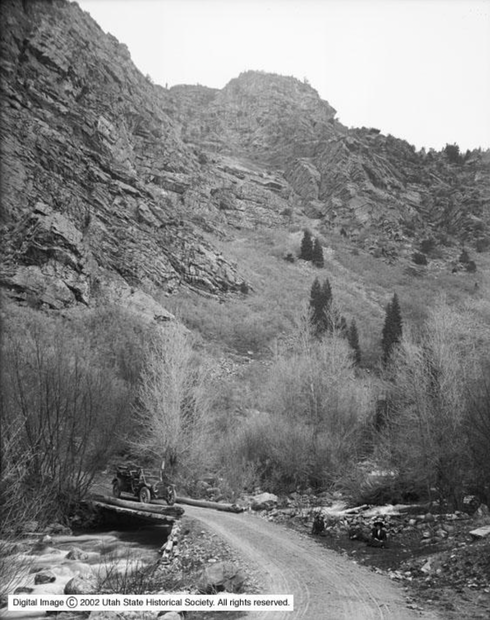
Photo Title: “In Big Cottonwood Canyon at Bridge.” [13] This photo from 1910 shows the dirt road which was shared by automobiles and livestock pulling wagons. For early canyon travelers, sections of the canyon walls would have appeared higher than they do now since the old road was down at creek level. This image shows a log bridge over the creek.
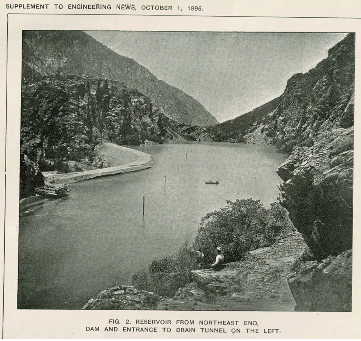
Photo Title: “Reservoir From Northeast End, Dam and Entrance to Drain Tunnel On The Left.” [14] This photo shows the original size of the reservoir which was naturally surrounded by the mountain walls with the manmade dam on the left. The rock with the Cuts isn’t visible in this photo, but was at the left.
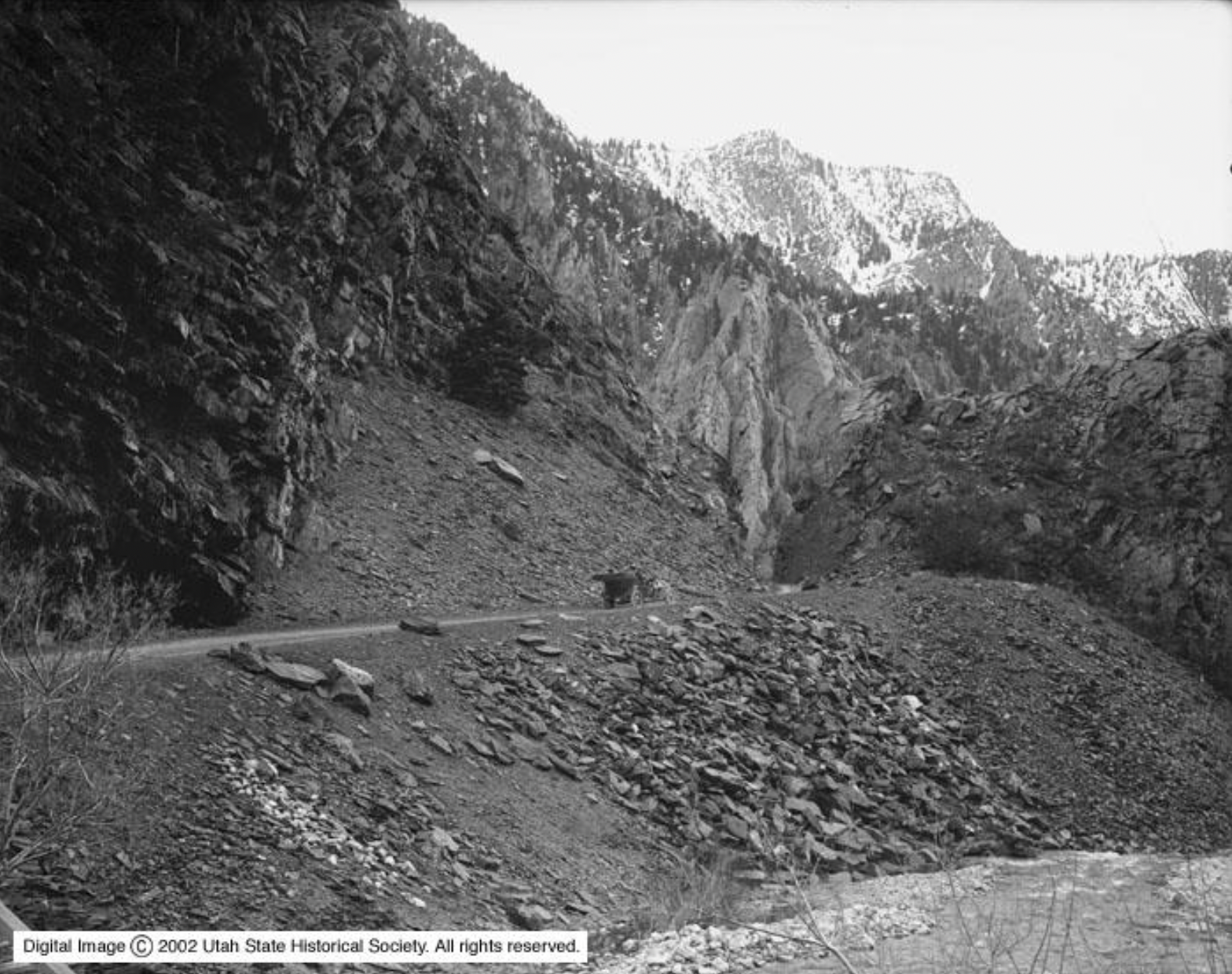
Photo Title: “In Big Cottonwood Canyon, Going up to Cut.” [15] This photo shows an automobile heading up to the 1895 Cut. You can see the deep walls of the original cut, sometimes called “Devil’s Gate.” This auto is driving downcanyon and the reservoir water is joining the creek at the bottom right. This Cut, the dugway, and this road were called the “Jones’ Hump.”
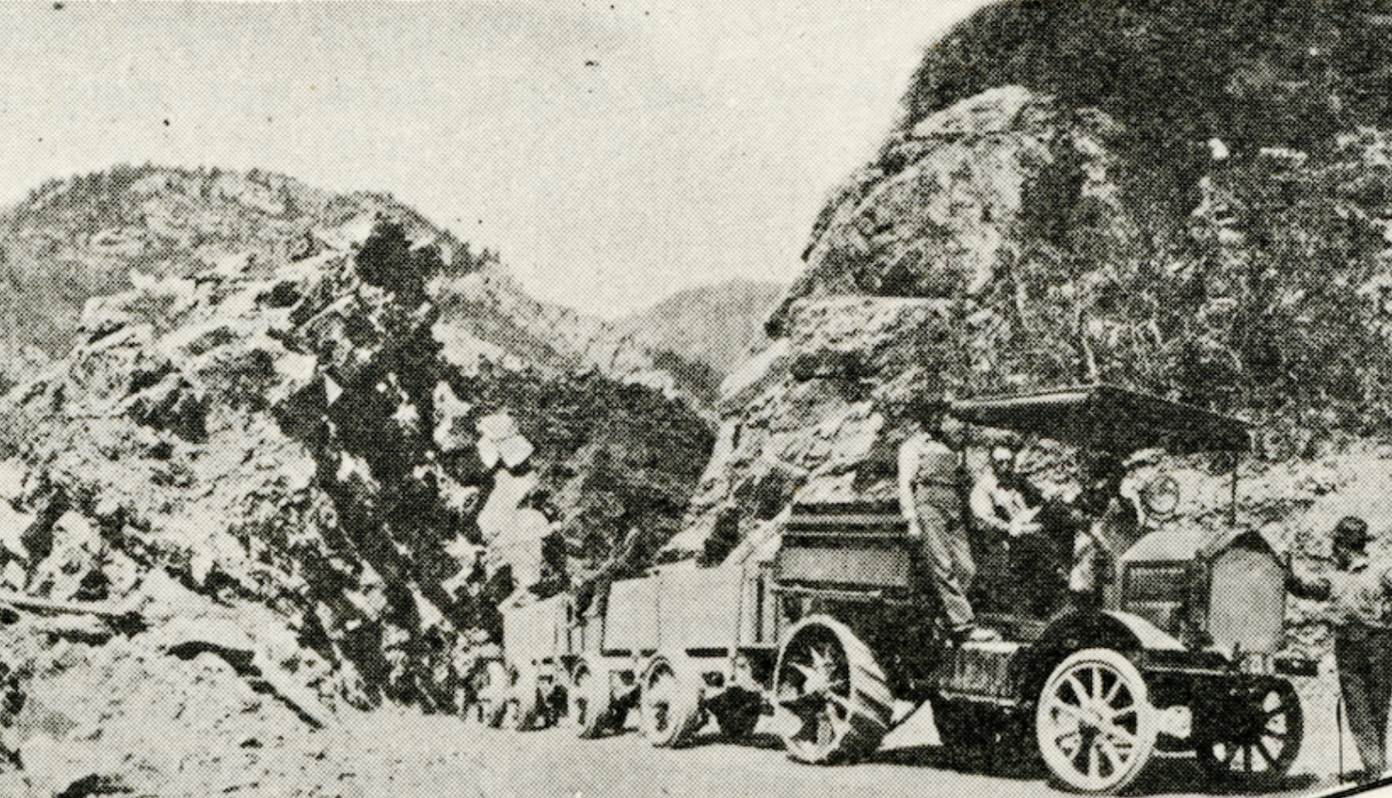
Photo Title: Looking upcanyon at a Knox tractor pulling ore trailers through the 1916 Cut. [16] This Cut, which is still used today, was made to decrease the road grade from the 1895 “Jones’ Hump.” Vehicles were needed to transport ore instead of horse teams due to water contamination.
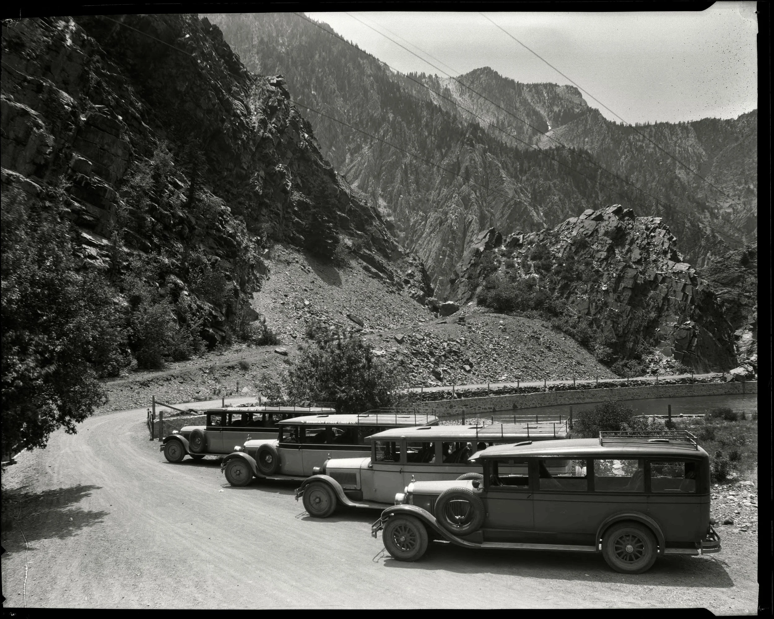
Photo Title: “Bingham Stage Line Company, Cadillac Buses in Cottonwood Canyon.” This image is looking downcanyon. The reservoir is to the right and the relatively flat road leading to the 1916 Cut can be seen wrapping around to the right with a fence between the road and the reservoir. That road and the cut would have been completed 10 years before this photo was taken. You can also see the steep road leading up to the old 1895 Cut with rocks blocking vehicle passage. [17]
Canyon Stories:
The “Canyon Stories” sections include personal stories, family histories, anecdotes, recollections, excerpts and other information that adds depth and colorful perspectives. Some information might be repetitive, and it has not been as carefully reviewed for accuracy and sources.